Skip to content

Ultra marathon edition

Lakeland 100

169 km · Coniston

2026 race

£48A2, unframed · VAT included where applicable

Personalise this printAdd a name, finish time and bib. Optional, at no extra cost.

Buying for a runner? Use their name and time, or leave these blank for the course alone.

Hours:minutes:seconds
ColourChalk · Classic map
Size42 × 59.4 cmSize guide
Drawn to scale beside a door 198 cm tall
FrameUnframedFramed +£51

UK delivery in 3 to 6 business days

Want the race date, a tagline or other map layers? Customise in full

Free UK and EU delivery · Made to order · Free reprint if it arrives damaged

About this print
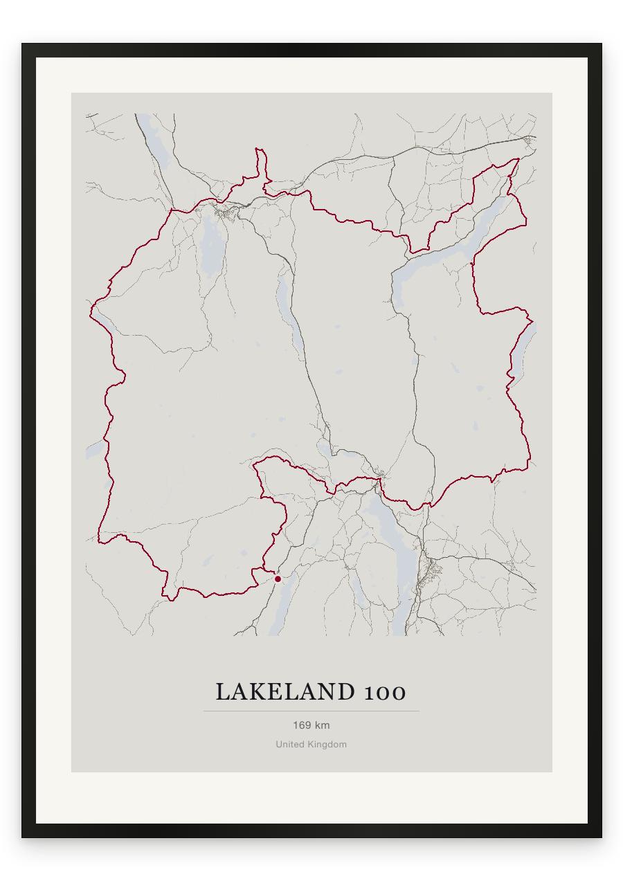
  • Drawn from the official Lakeland 100 course, 169 km · Coniston.
  • 6 palettes (Chalk, Frost, Lichen, Blueprint, Graphite and Forest), each as a classic map, plus 9 new route designs, Dot Line, Curtain, Riso, Contour, Survey, Swiss, Aurora, Pixel and Kilometres.
  • Personalise every style with your name, finish time and bib number.
  • Designed in London, printed to order on archival paper.
Delivery and returns

Made to order · Free UK and EU delivery, UK in 3 to 6 business days · elsewhere from £8.95 (rates and delivery times)

Free reprint if it arrives damaged or misprinted: just tell us within 14 days. As it's made to your details, there are no change-of-mind returns (returns policy)

Secure checkout by Stripe

Paper and sizes

Unframed, or framed at A2, A3 or A4 and ready to hang. Every size is standard, so an off-the-shelf frame fits too. Size guide

Ran a different race? Build your own route print

The frame

Solid wood, 2 cm face, shatterproof acrylic glazing, no mount. Arrives ready to hang.

Made for A2, A3 and A4 prints and delivered to the UK, the EU (except Iceland), the US, Australia, New Zealand, Japan and Singapore.

Map data © OpenStreetMap contributors

Running it? I'll email you when the 2027 course is ready, then once a month with new editions. Unsubscribe any time.

Course facts

Distance as drawn
168.6 km (104.8 miles)
Route
A loop, starting and finishing in the same place.
Start and finish
Near Coniston
Climb
About 5120 m up and 5115 m down
Highest point
About 665 m above sea level, at 111.2 km
Lowest point
About 45 m above sea level
Biggest climb
About 510 m, from 106.4 km to 111.3 km
Biggest descent
About 490 m, from 47.8 km to 55.1 km
Passes near
Dixon Ground (0.2 km), Seathwaite (11.5 km), Dalegarth (21.8 km), Boot (22.3 km), Wasdale Head (31.1 km), Buttermere (42.1 km), Braithwaite (52.9 km), Portinscale (54.6 km), Great Crosthwaite (56.3 km), Keswick (57.0 km), Threlkeld (70.8 km), Dockray (80.2 km), Wreay (89.1 km), Dacre (92.7 km), Pooley Bridge (98.1 km), Roehead (99.4 km), Howtown (106.5 km), Sadgill (127.7 km), Kentmere (131.6 km), The Nook (132.4 km)
Heights along the course
Start 50 m, 5 km 295 m, 10 km 170 m, 15 km 255 m, 20 km 70 m, 25 km 280 m, 30 km 70 m, 35 km 465 m, 40 km 110 m, 45 km 295 m, 50 km 390 m, 55 km 75 m, 60 km 315 m, 65 km 325 m, 70 km 135 m, 75 km 395 m, 80 km 300 m, 85 km 345 m, 90 km 265 m, 95 km 145 m, 100 km 270 m, 105 km 210 m, 110 km 480 m, 115 km 300 m, 120 km 260 m, 125 km 380 m, 130 km 285 m, 135 km 430 m, 140 km 240 m, 145 km 120 m, 150 km 55 m, 155 km 105 m, 160 km 110 m, 165 km 340 m, finish 50 m
Race day
Friday 23 July 2027

We measured these from the route drawn on the print. How we measure