Style Classic map
The course
An Abbott World Marathon Major.
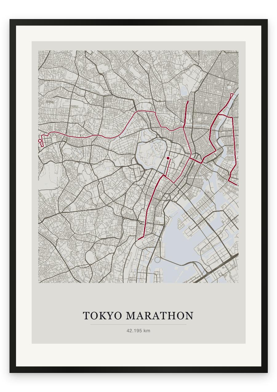
It starts high, outside the Tokyo Metropolitan Government Building in Shinjuku, and the first kilometres fall away downhill between the towers. The fastest running of the day, and the easiest to waste. The course heads east through Ichigaya and Jimbocho, then makes the first of its turns at Ueno-hirokoji, near Ueno Park, at 10.6 kilometres, doubling back through Kanda to Nihonbashi and the merchant heart of old Edo. From there it runs north-east into the older city: Asakusa and the turn at Kaminarimon, the great gate of Senso-ji, then back over the Sumida past Kuramae and Ryogoku, home of sumo, around halfway. The course then drops south to Monzen-nakacho and the Tomioka Hachimangu shrine at roughly twenty-four kilometres. The return north is long and straight, over a short bridge ramp near twenty-eight kilometres, the only real rise after Shinjuku, then back through Nihonbashi, Ginza in the mid-thirties, a final turn at Tamachi at 37.5 kilometres, and north again through Hibiya. The finish is on Gyoko-dori, the avenue running from Tokyo Station towards the Imperial Palace, at the Wadakura gate crossing. Flat almost the whole way. A course decided by patience rather than terrain.
- Start
- Tokyo Metropolitan Government Building, Shinjuku
- Finish
- Gyoko-dori by Tokyo Station, at the Wadakura Gate intersection beside the Imperial Palace grounds
- Shape
- point-to-point
- Terrain
- A downhill opening out of Shinjuku, then flat almost the whole way, with one short bridge ramp of about 3% at roughly 27.7km. The course doubles back on itself repeatedly; the official turning points are Ueno-hirokoji (10.6km) and Tomioka Hachimangu (23.95km), with further reversals at Kaminarimon (~18.2km) and Tamachi (37.5km).
- Tokyo Metropolitan Government Building, Shinjuku (start)
- Ichigaya and Jimbocho
- Ueno-hirokoji turning point, near Ueno Park (10.6km)
- Kanda and Nihonbashi (~13.3km)
- Asakusa and the Kaminarimon gate of Senso-ji (~18.2km)
- Kuramae Bridge and Ryogoku (~20.6km, around halfway)
- Tomioka Hachimangu, Monzen-nakacho turning point (~24km)
- Ginza (~33.5km)
- Tamachi turn (37.5km)
- Hibiya and the Gyoko-dori finish by Tokyo Station