Style Dot edition
The course
An Abbott World Marathon Major.
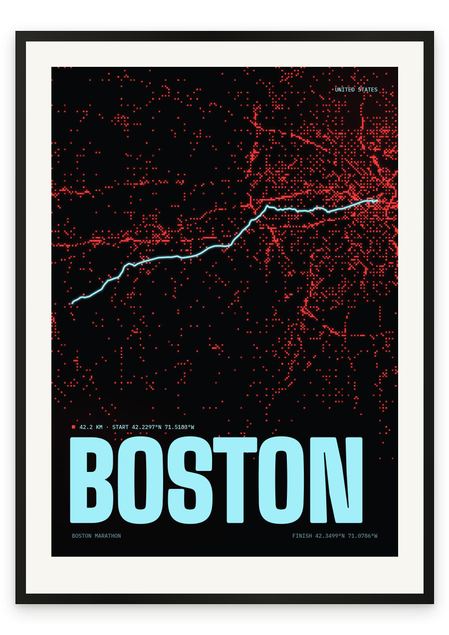
Point to point, west to east, and it starts by falling. Main Street in Hopkinton is the highest ground on the course, and the first miles drop hard along Route 135, which is why Boston ruins quadriceps and why its times are not eligible for world records. Ashland, Framingham, Natick: rolling, deceptive, quick. Near halfway the road passes Wellesley College and the scream tunnel, a quarter of a mile of noise you hear long before you see it. Then Route 16, Newton Lower Falls, and the right turn at the firehouse onto Commonwealth Avenue. Here the course collects its debt. Four hills between sixteen and twenty-one, the last of them Heartbreak, only eighty-eight feet of climb and arriving at exactly the wrong moment. Past Boston College the road tips down to the reservoir, bears right onto Chestnut Hill Avenue and into Cleveland Circle, then turns left onto Beacon Street for the long run through Brookline. Kenmore Square at twenty-five, under Massachusetts Avenue, one short rise out of the underpass. Right on Hereford. Left on Boylston. The last straight is visible the entire way down, ending outside the Boston Public Library.
- Start
- Main Street, Hopkinton, Massachusetts — the highest point of the course
- Finish
- Boylston Street at Copley Square, beside the Boston Public Library
- Shape
- point-to-point
- Terrain
- Net downhill — around 459 feet lower at the finish than the start — but far from easy. A steep drop in the opening miles, rolling ground through Ashland to Wellesley, then four hills on Commonwealth Avenue in Newton between roughly miles 16 and 21, the last being Heartbreak Hill (about 88 feet of climb). The course is ineligible for world-record ratification on two counts: the net drop exceeds the permitted limit, and the separation between start and finish exceeds half the race distance.
- Hopkinton start, Main Street / Route 135
- Ashland, Framingham and Natick
- Wellesley College 'scream tunnel', near halfway
- Newton Lower Falls and the firehouse turn onto Commonwealth Avenue
- The four Newton hills, ending with Heartbreak Hill (miles 20–21)
- Boston College and Chestnut Hill Reservoir
- Cleveland Circle and Beacon Street through Brookline
- Kenmore Square
- Hereford Street and Boylston Street
- Copley Square finish