Style Classic map
The course
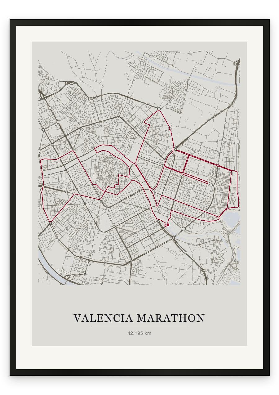
Valencia sets you off beside the Ciutat de les Arts i les Ciències and then does everything it can to stay out of the way. The opening kilometres run east toward the water — the port, Veles e Vents, and the low straight streets behind the Cabanyal seafront, where the route was moved a block inland to take the wind off you. From there it turns north through Benimaclet and the university district, onto the broad northern ring road, and back down the long avenues of Blasco Ibáñez past Mestalla. At twenty-eight kilometres the course crosses the bed of the Turia — a river turned into a park, and the best of the city — enters the old town beneath the Torres de Serranos, and reaches the Plaça de l'Ajuntament at thirty. Then west over the river again for the long avenues toward the Bioparc and General Avilés, where the only rise of the day sits: about one per cent, and brief. What is left is wide and straight. Colón, then the run back out to the water, and a finish on the blue walkway laid across the lake in front of the Hemisfèric.
- Start
- Plaça de la Marató, beside the Ciutat de les Arts i les Ciències, Valencia
- Finish
- The floating walkway over the water at the Ciutat de les Arts i les Ciències, in front of the Hemisfèric
- Shape
- loop
- Terrain
- Flat and at sea level — total elevation gain of roughly 47m across the full distance. Wide avenues and long straights throughout; the only rise is a gentle pull of about 1% on the western leg toward the Bioparc and General Avilés, around 31-33km. Wind off the sea, not gradient, is the variable.
- The port and Veles e Vents
- Avenida Blasco Ibáñez and the Mestalla stadium
- The Turia riverbed park and the Torres de Serranos
- Plaça de l'Ajuntament and the Bioparc
- Calle Colón and the Hemisfèric finish