Style Classic map
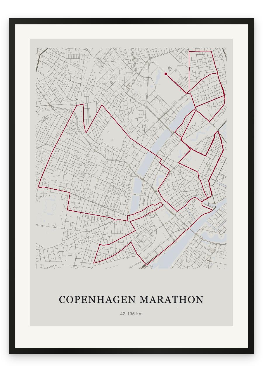
The course
The race begins on Øster Allé, beside Fælledparken, and returns to the same stretch of road at the end: a single loop of the city, and it wastes none of it. The first third runs out through Østerbro and the inner city before crossing to Christianshavn at around ten kilometres, over Knippelsbro and along the old canals, tracing the line of the Stadsgraven moat on Amager before Langebro carries the course back across the harbour. At fourteen kilometres comes Dronning Louises Bro and the crossing into Nørrebro. Frederiksberg Allé arrives at twenty-four, tree-lined and very slightly downhill. Istedgade and Vesterbro follow, past Tivoli, then the harbour again around thirty-one, by the Black Diamond and BLOX. The final stretch is the oldest part of the city: Kongens Nytorv, Nyhavn, Amalienborg, the yellow terraces of Nyboder at thirty-six. Then back to Øster Allé. There is almost no elevation in it — roughly eighty-five metres across the whole distance — which is why the fast times come here, and why there is nothing to blame at the end but the legs.
- Start
- Øster Allé, beside Fælledparken, Copenhagen Ø
- Finish
- Øster Allé, beside Fælledparken — the same stretch of road as the start
- Shape
- loop
- Terrain
- Flat. Roughly 85 m of total elevation gain across the whole course; a few short bridge ramps and one gentle descent along Frederiksberg Allé. Road surface throughout.
- Knippelsbro and the Christianshavn canals (~10 km)
- Dronning Louises Bro into Nørrebro (~14 km)
- Frederiksberg Allé (~24 km)
- Nyhavn and Amalienborg (~33 km)