Style Dot edition
The course
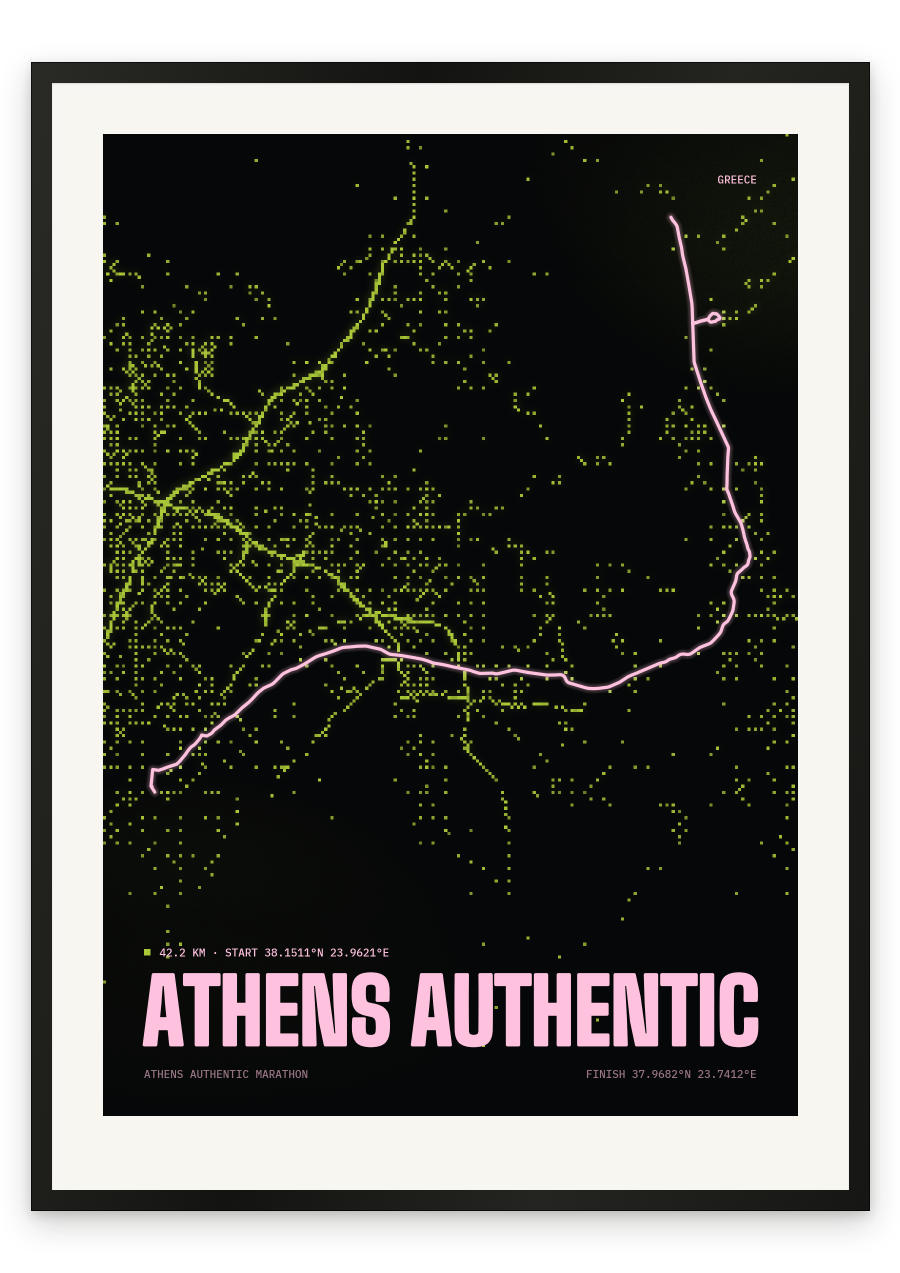
It begins on the plain where the distance was invented. The start is at Marathon, and the opening kilometres loop past the burial mound of the Athenian dead before turning south. Through Nea Makri the road runs near the Aegean, flat and lightly rolling. Then it turns inland and the day changes character. From around 10 km the road tilts upward. It is never steep. It simply does not stop. Past Rafina and Pikermi, on through Pallini and Gerakas, the climb becomes the race: a sustained grind from roughly 20 km to 31 km, topping out near 250 metres, exactly where a marathon is usually decided. The summit comes at Stavros, on Mesogeion Avenue, just before Agia Paraskevi. From there the road falls the whole way into the city — Mesogeion through Kato Chalandri and Cholargos, the Katechaki junction, Michalakopoulou, then Vasilissis Sofias past the Megaron concert hall, the Presidential Mansion and the edge of the National Garden. The final turn is into the Panathenaic Stadium: marble, horseshoe-shaped, and the place the 1896 Olympic marathon ended.
- Start
- The town of Marathon, on the plain north-east of Athens, beside the Marathon Tomb
- Finish
- The Panathenaic Stadium (Kallimarmaro), Athens
- Shape
- point-to-point
- Terrain
- Rolling coastal opening, then a long sustained climb from roughly 10 km to 31 km reaching about 250 m, with the high point at Stavros on Mesogeion Avenue, followed by a continuous descent into the city.
- Marathon Tomb, in the opening kilometres
- Nea Makri and the coastal plain
- Rafina, Pikermi, Pallini and Gerakas — the long climb, hardest from roughly 20 km to 31 km
- Stavros on Mesogeion Avenue, the high point near 31 km, then Agia Paraskevi, Kato Chalandri and Cholargos
- Vasilissis Sofias, the Megaron, the Presidential Mansion and the National Garden
- Panathenaic Stadium finish